The BAS Day School took place at St Nicolas Church Hall, Newbury, on 11th October 2025. There were 50 attendees. After the Chair, Andrew Hutt, welcomed everyone, there were the following presentations:
Recent archaeological work in West Berkshire
Sarah Orr, Principal Archaeologist, West Berkshire Council
Sarah explained the work she and her team have been involved in over the past year, including:
- Developer-funded archaeological and historic investigations at Henwick Park, Cold Ash (Middle Iron Age activity); Welford Park stable yard; Bere Court, Pangbourne (Medieval and post-Medieval pottery and tiles); Hodcott buildings, West Ilsley; and Keepers Cottage on the River Lambourn
- Consultations on land management
- Council proposals regarding climate change including a solar farm at Bloomfield Hatch Farm, Grazeley
- Listing and de-listing of Historic England’s designations
- Updates on the Historic Environment Record (HER) and proposed changes to the National Record of the Historic Environment (NRHE) to avoid duplication of effort
- Outreach work, including an event on Greenham Common to mark 25 years since it reopened to the public
- Events at the West Berkshire Museum
- Proposed new developments in and close to Newbury
- Future planning legislation changes
Recent archaeological work in East Berkshire
Edwin Wood, Archaeology Officer, East Berkshire
Edwin gave a summary of sites in East Berkshire that have been excavated over the past year:
- Kimbers Lane, Maidenhead – primarily Mesolithic with approximately 9,000 lithics recorded, including a rare tribach that are normally of late Neolithic or Bronze Age. Also evidence for Bronze Age and Roman activity on the periphery of the site
- Water Oakley Quarry, Bray – ongoing archaeological excavations have found late Iron Age ring ditches and a Roman rural settlement with wells, pottery and coins
- Dedworth Road, Oakley Green, Windsor – Bronze Age cremations, Iron Age ditch and an Anglo-Saxon building
- Piggott Church of England School, Wargrave – intense prehistoric activity from the Late Neolithic (including polished axe head and grooved ware pottery) to the Early Bronze Age
- South Wokingham distributor road – Iron Age ring ditches and pottery
- Burnt Mount, Arborfield – a black layer in the trench is a possible burnt mound. Phase 2 will be in 2026
Mesolithic site at Kintbury, Kennet Valley
Paul Riccoboni, Environment Agency archaeologist, Juan Chacon, AOC Archaeology Group and Jessica Taylor, AOC Archaeology Group
This site was excavated as part of an Environment Agency river restoration project on the River Kennet. As it included gravel extraction, an archaeological excavation was required, which led to the discovery of a site of national interest. A large assemblage of microliths (blades, scrapers etc) and animal bone were found in pits and in stake holes of a potential five structures. This showed possible tool production, hunting and food preparation, interpreted as a seasonal Mesolithic camp, part of a bigger Mesolithic landscape in the Kennet Valley that was intensively exploited. There was also evidence of later occupation, from the Neolithic (pottery), Bronze Age, Iron Age and Roman and post-Medieval (water meadow system) periods. This site has contributed to Historic England’s ‘Tracing their Steps’ project and a dig diary recorded parts of the excavation that may appear on a future Digging for Britain series.
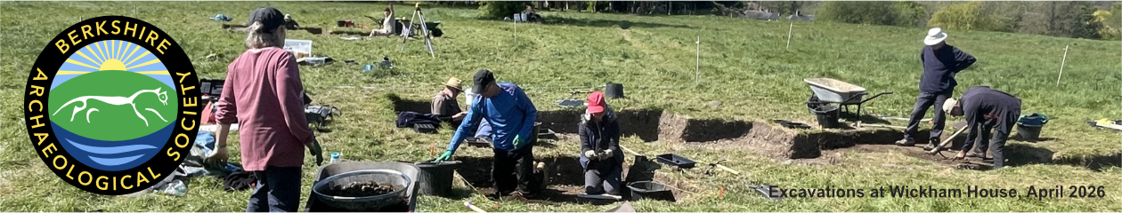
Archaeological excavations at Wickham House
Keith Abbott, Berkshire Archaeological Society
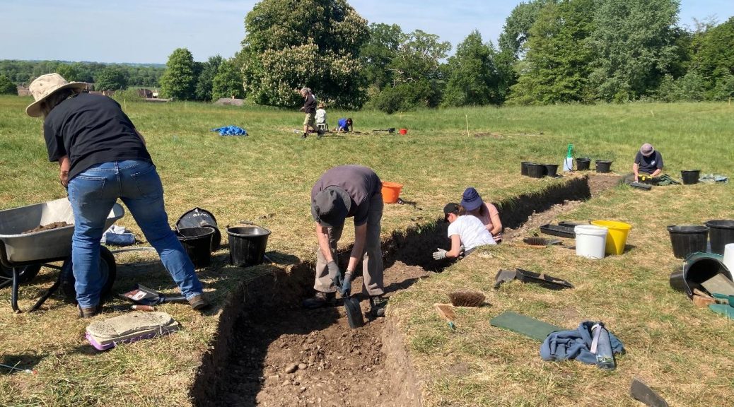
Between April and June 2025, excavations were carried out in the grounds of Wickham House, north-west of Newbury. Part of the route of the Roman road of Ermin Street was known to traverse this site and earlier geophysical surveys by BAS revealed an intersection between two roads, potential settlements alongside the roads, and roadside ditches. A total of 8 trenches were dug, with trench 1 containing Roman pottery, evidence of iron working (slag and hammer scale) and a spindle whorl. Trench 2 initially revealed a cobbled surface of large flints, which could be the floor surface of a Medieval building on top of the Roman road. Beneath this surface Roman artefacts included coins, Samian ware pottery, a brooch, hair pin and glass. In one of the roadside ditches there was a green, glass melon bead, which are often association with military sites and a possible iron stylus would be evidence of literacy. Other artefacts included a thumb pot containing a second century coin. Trench 4 revealed a possible masonry wall of a Roman building alongside the road, in which was found a second century brooch, Roman glass, pottery, hob nails and buckles.
Post-excavation work is ongoing and involves specialists and many volunteers. A total of 3,591 pottery sherds were found and animal bone analysis to date has shown they are mainly from sheep or goat, but there is also pig, cattle and horse bone. A total of 16 Roman coins, 27 fragments of Roman glass (including from green storage bottles and orange jugs) and 560 iron objects were excavated. The initial interpretation is of a Roman building alongside the road, where iron production took place, surrounded by ditches and fields, as well as a Medieval yard and building. No evidence of pre-Roman occupation was found.
A total of 116 people took part in the excavations and post-excavation work (the latter is still ongoing), while 91 people attended the open days. A draft interim report will be available before the 2026 excavations.
The Portable Antiquities Scheme (PAS) in Berkshire, 2024/25
Phil Smither, Finds Liaison Officer (FLO), Berkshire
Phil explained the history and role of the PAS and FLOs in the recording of archaeological objects found by the public. In the past year in Berkshire, there were finds from all periods from the Palaeolithic to the modern day, although FLOs are primarily interested in finds at least 300 years old. Finds last year included:
- Iron Age/Roman coin hoard, of two types of Verica coin
- Iron Age swan neck pin dated to 550-50 BC
- Complete Roman copper alloy equal-ended plate brooch, c.AD 150-250 and an incomplete one from c.AD 100-200
- Roman coins including of Valerian II from AD 256-258 which is unusual and Licinius II from AD 318-324
- Early Medieval copper alloy button brooch (5th-6th century) from Welford
- Medieval silver penny, dated from AD 1140-1145
- Late Medieval silver double petard, dated from AD1467-1477 from Bucklebury
- Hoard of 50 Roman coins from the borough of Windsor & Maidenhead
Roman Rural Settlement at Cake Wood
Abby Christopher, UCL and Phil Smither, FLO, Berkshire
Cake Wood is situated close to Littlecote Roman Villa, near the confluence of the Rivers Kennet and Dun. The same metal detectorist has visited the site for approximately 30 years and it was their 2023 discoveries, comprising 969 coins and 100+ other objects, that prompted Phil Smither to visit the site. Key finds included:
- Incomplete bust, possibly of Apollo dating from the second century AD
- Cockerel figurine
- Roman pendants
- Roman coins
Phil approached the University of Reading and archaeology students carried out geophysical surveys. Abby Christopher used this site for her dissertation for her archaeology degree, that related to the Roman Road Settlement Project, with a case study of Cake Wood, Littlecote Villa and Rudge. The geophysics surveys revealed roads, ditches, barrows, enclosures and field systems, suggesting habitation from the late Iron Age to post-Medieval. Cultivation at Cake Wood started in the Iron Age and through the Roman period, with the highest percentage of crops being barley and spelt wheat, but also Emmer and free-threshing wheat, rye, pulses and flax. Littlecote Roman villa was initially a roadside settlement that transitioned into a villa and Cake Wood was an enclosed farmstead. Together they are classified as a ‘Villa Estate’.
A multi-period site at Hartshill Copse, Thatcham
Pierre Manisse, Thames Valley Archaeological Services (TVAS)
Hartshill Copse lies within an active gravel quarry and has been excavated by various archaeological consultancies since the 1980s. TVAS were invited to carry out an excavation for Phase 4 of the site. The site has evidence of settlements from the late Bronze Age to the Medieval period. This includes Bronze Age cremations and pottery, Iron Age round houses and enclosures, pits and curving ditches from the late Bronze Age to the early Iron Age. There is also evidence of early to middle Iron Age iron working including smelting furnaces and slag as well as smithing activity. The site has Roman enclosures and field systems and an early Roman cremation burial with in situ pottery. There is also evidence of an 11th – 12th century Medieval building and enclosures with boundary ditches, possibly of a farmstead.
Introduction to the Historic Ridgeway LiDAR Project
Rebecca Bennett, PTS Consultancy
Rebecca introduced us to the project team and partner organisations and to the Historic Ridgeway Project, which is a 3-year project that started in September 2023. LiDAR (Light Detection And Ranging) is a remote-sensing technology that can be used to generate topographical maps and there is LiDAR coverage for all of England, Wales and Scotland. This project used the LiDAR data for a 500m buffer along a 30-mile stretch of the east Ridgeway. This data was processed into digital surface models and digital terrain models of 1m resolution to identify archaeological monuments present and their condition. HER monument data, OS maps and satellite imagery were also used. Volunteers for the project underwent training in order to access the Ridgeway LiDAR Portal, where they then worked independently, with monthly Zoom catch-ups. Phase 1 was the Field Boundary Mapping Project, with 2,796 features mapped, of which 80% has been reviewed so far. Phase 2 is the Feature Mapping Project, to record all other features of archaeological interest. To date, 243 features have been identified, including banks, ditches and enclosures. Once all the data has been reviewed, it will be sent to the HER Officers for input on to the HER.