Given on Saturday 11th December 2021
Blounts Court by Nigel Spencer
From Nigel we learned that the house had been built around 1350, bought by Thomas Blount in 1360 and renamed Blounts Court. The building was repeatedly extended over the centuries. After various private owners, Blounts Court was acquired by Johnson Matthey Plc in 1975, who own it to this day, using it as their Technology Centre.
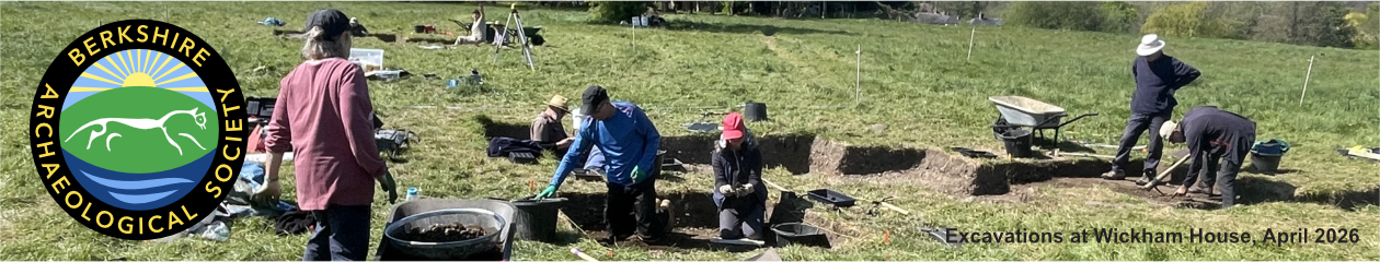
In 2013, BAS conducted a geophysical survey on the lawns to the front east of the house, where scorch marks had been observed. The results indicated the remains of a building of approximately 30m by 12m. In 2014, excavation started, and revealed the remains of a floor with chalk block foundations, and Georgian walling. We saw photographs of these excavated remains – always so exciting to see what geophysical ‘blobs’ turn out to be! In 2015, an auger survey showed the extent of the chalk floor, and further excavations revealed a mortared flint wall.
In 2016, findings suggested that the Georgian wall was the border of a garden. Variations in the mortared flint wall suggested different stages of construction, and so five separate mortar samples were sent for dating. In 2017, radiocarbon dates showed that the wall was predominantly Roman, and was demolished in the 10th century. The building with the chalk floor was dated to the 16th-17th centuries.
A picture showing the trenches with the resistivity survey results as background illustrated what had been found, and where, in relation to Blounts Court. Another picture by Tim Lloyd, of a reconstruction of Blounts Court in the 16th-17th centuries, and showing a barn/building on the chalk floor, brought to life the geophysical survey and excavation results.

2018 was Johnson Matthey’s 200th year of trading. Nigel and Andrew Hutt gave a talk about BAS’s work and findings at Blounts Court.
In 2019, excavation revealed the end of the Georgian wall, which was cut into a substantial dressed flint faced wall, which is in line with the existing south end of Blounts Court. A photograph showed us that where the Georgian wall met the ‘new’ wall there was a single course of brickwork, laid in a square pattern and with a concrete infill, resembling the base for a pillar.
We all know what happened in 2020-2021; Covid-19 affected everything!
In 2022, it is hoped that further excavations will reveal more information about the interesting ‘new’ wall, and nearby geophysical anomalies.
The Steventon Causeway, by Catherine Petts
Catherine started her talk by showing a photograph of the Causeway entitled ‘The View from my Front Door’. Steventon had been in Berkshire, until boundary changes placed it in Oxfordshire. Catherine described the area as ‘wet’, with Steventon being a ‘spring’ village on the edge of the North Wessex Downs.
We looked at an aerial photograph of Steventon, with the Causeway, clearly visible because of the trees that grow along it, running from south-west to north-east through the village. The Causeway runs between St. Michael’s Church in the east and The Green in the west, but, as Catherine went on to explain, there seems to be no clear reason why the Causeway was built.
We saw photographs of the Causeway, paved with limestone and lined with trees. A diagram of a cross-section showed small banks and ditches to either side of the larger bank of the Causeway, which appears to be raised between 3 and 5 feet above the surrounding area. The limestone paved path, which is 6 feet in width, runs along the top of the Causeway bank, which is considerably wider, at about 24 feet across. With the Causeway being nearly 1 mile in length, we were able to comprehend the very large number of man-hours, and associated cost, which would have been involved in building this structure.
And yet, as Catherine explained, there is nothing in the ancient records to say by whom or why the Causeway was built. She talked of the myths surrounding ‘jolly monks’, and how some people had thought that the Causeway had been built to link St. Michael’s Church with another religious building. But there had only ever been two monks at Steventon, and it did not seem likely that this huge and expensive undertaking would have been arranged for their benefit.
We looked at a map which showed how the Causeway appeared to have preceded the village, which it divides into two. We looked at LiDAR images of Steventon and the surrounding area. Catherine suggested that the Causeway, which clearly predates the village, may have been a prehistoric boundary bank. She talked of Bronze Age and Iron Age settlements nearby, who could have included this good grazing land in their territories.
I hope that one day excavations at the Causeway will reveal dateable artefacts and other evidence to explain this rather lovely, but mysterious structure!
Runnymede, learning geophysics: the results by Andrew Hutt
Andrew described the 2021 BAS geophysics training and survey project at Runnymede, Surrey. The project involved the owners of the land; the National Trust (NT), as well as Surrey Council Archaeological Unit.
The project involved 29 learners, ranging from students to the newly retired. They learned about geophysics techniques, and the currently known archaeology of the fields at Runnymede. They then got hands-on experience of collecting geophysical data at Runnymede. Keith Abbott taught the use of an earth resistance meter, and Ewan Montgomery taught how to use a gradiometer. According to Andrew, he himself just ‘stomped around and got in the way’, but I’m sure that wasn’t true! Back indoors, the learners saw how the data they had collected provided more information about the archaeology at Runnymede.
We looked at an image of the NT’s Historic Environment Record for Runnymede, and saw various features that had once existed there, such as Epsom racecourse. An aerial photograph showed where the Magna Carta was probably signed; once an island, now just slightly raised land with trees around part of it.
A diagram of the surveyor’s grid showed the two areas that were surveyed. We saw the Area 1 gradiometer results, with anomalies at its north end on the edge of the ‘island’, and then very little towards the middle, with just a couple of linear features that may have been ditches. The Area 1 earth resistance results showed a similar picture of ‘busy’ areas at the edge of the ‘island’, with little going on in the middle. Area 2, on the edge of the ‘island’, showed many features, possibly ditches and pits that had been dug and then filled in, as well as areas of burning. The earth resistance results confirmed this picture of much activity.
In conclusion, the evidence appears to suggest that King John’s barons placed camps around the edge of the island and left the centre to be used as a display area, and for jousting.
Andrew went on to talk about what BAS hopes to do at Runnymede in 2022. Details of the WWII Anti-Aircraft (AA) trenches are to be studied to confirm that the anomaly in Area 1 represents an AA trench. There is to be more geophysics around the edge of the ‘island’, and one of the pits at the north end of Area 1 is to be excavated, to recover environmental evidence and, hopefully, artefacts!
Report by Joan Burrow-Newton