
Part of a series of bulletins from the BAS excavations at Wickham HouseFollow the project on our YouTube channel
Attendees: Lindsey, Dee, Debbie C, John M, Thalia, Nigel, Carol, Phil U, Stuart, Stewart, Julian, Martin, Susanne, Philip, James L, Chloe L, Doug and Keith
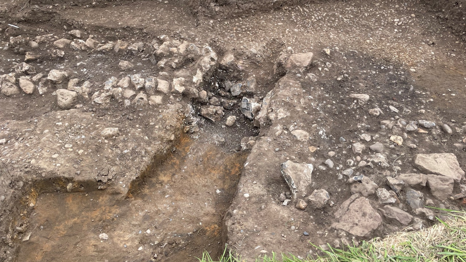
The day started with cleaning at the south end of Trench 16000 to begin the process of recording and planning for the archaeological horizon revealed over the past two week of the excavation. The results of the detailed cleaning were impressive with some different contexts being identified in this area of the trench, as can be seen in Figures 1 and 2. These include the two faces of the masonry wall and its lime/chalk mortar core that can clearly be seen (in the section across the wall excavated and recorded in 2025), a large pit, gravel fills of the construction trench and a number of gravel surfaces.
The overcast weather was ideal for photography, so this element of the recording process was prioritised. However, John, Thalia and Susanne began the process of planning and completion of context sheets. Completion of this recording will be continued next week before further excavation is initiated.

At the northern end of Trench 16000 the alignment revealed to the south was projected to where it is hoped the masonry footings continue, and possibly continue along a return heading to the northeast or southeast. The initial GPR survey images of this area of the site have not yet been able to offer a clear indication of the morphology of the wall in this area – so tried and tested “old school” methods were applied by Martin and Stuart as seen in Figure 3.

Figure 3. Martin and Stuart project the line of the masonry wall northwards in Trench 16
In Trench 15000 Lindsey, Dee and Debbie continued to clean the gravel surface revealed earlier in the week. A sondage revealed the level of the fill of the Roman road’s ditch which was extended towards the likely agger surface of the road in the south of the trench. Now the level of the archaeological horizon has been established, work will continue to the west to define the rest of the Roman road, its northerly ditch and the lane which will be planned and recorded in the coming week. The extent of the spoil heap after only two weeks of excavation in Figure 4 shows the energy that has been brought to bear by the team of volunteers during the past six days of excavation. Now that the first objective of revealing the archaeology is within sight, projects will be assigned next week to address the goals of the research questions for this site in the week’s head.

In addition to the excavation work, Philip, supported by Phil U, James L, Nigel and Stewart, undertook high resolution earth surveys to assess the archaeological potential for further settlement alongside the Roman road to the southeast of the site. The planned surveys will add further insight into the full extent of this roadside settlement and the functions taking place during different periods of occupation.
