
Saturday 3rd October 2026
The Cornerstone, Norreys Avenue, Wokingham, Berkshire, RG40 1EU
Recent archaeological work in Berkshire
Beth Asbury, Assistant Archaeologist, West Berkshire Council
Beth began her presentation by outlining the duties of the West Berkshire Council (WBC) archaeology service (East Berkshire is covered by Berkshire Archaeology). Her duties include administering the Historic Environment Record (HER) and outreach work, while that of the Principal Archaeologist includes advising on planning and agri-environment schemes as well as education and outreach work. Sarah Orr has retired from the post of Principal Archaeologist, and it is uncertain when this vacant post will be advertised.
Over the past year, developer-funded work has included the 17th century East Barn at Hampstead Norreys, an 18th century barn at Bucklebury, a geoarchaeological borehole study at Hoad Way, Theale that has yielded Upper Palaeolithic peat, an application for a new burial ground in Compton and a watching brief at the Cart Shed at Welford Park, where several inhumations were discovered.
Advice on research projects included BAS’s Roman settlement site at Wickham House and a magnetometer survey at Sheepdrove Farm, Lambourn. There were also several WBC projects including approval of the redevelopment of Newbury Wharf. Seven new Locally Listed Heritage Assets were added and liaison with Historic England included Sheep Down long barrow at East Ilsley and Membury Camp hillfort.
A new version of Historic England’s Heritage Gateway (where you can search for archaeological sites, historic buildings and HERs) was launched this year. HER updates over the past year include Edinburgh Terrace, Newbury (Michael Bond, the author of the Paddington Bear stories, lived in one of the houses), Inkpen Crocus Field, Donnington Castle Oak and Bronze Age waterholes at Green Park, that yielded human and animal bones, a wooden ladle, a shale bracelet fragment and pottery.
Outreach work included a free archaeological tour of the West Berkshire Museum in March. Several events have been and will be happening at Shaw House in Newbury, including the Council for British Archaeology Wessex annual conference on 7 November 2026.
Recent portable antiquity finds in Berkshire
Dr Phil Smither, Finds Liaison Officer (FLO), Berkshire
Phil began his talk by explaining how the Portable Antiquities Scheme (PAS) works. It is managed by the British Museum and started in 1997 in response to the 1996 Treasure Act. There is generally one Finds Liaison Officer (FLO) per county and Berkshire has had its own FLO since 2018. Phil’s role includes advising on best practice and recording objects on the PAS database, a new version of which was launched this summer. 95% of the finds are from metal detecting and it is hoped that metal detectorists will be trained to add their own data to the database.
To date, there are over 10,000 finds from West Berkshire and over 14,000 from the rest of the county. They cover all periods from the Palaeolithic to Modern, and some of the best finds from Berkshire over the past year include:
- Iron Age coins featuring Verica from the Atrebates tribe from Windsor & Maidenhead (W&M) and West Berkshire.
- Roman hoard of mixed, late 2nd century coins from W&M.
- Roman brooches, including 2nd and 3rd century ones from West Berkshire and W&M, one of which is shaped like a bird.
- Copper alloy Iron Age/Roman bead from West Berkshire.
- Roman cloak pin (too thick to be a hair pin) from Wokingham.
- Middle Saxon large, incomplete copper alloy key, probably 9th century, from W&M.
- Early Medieval incomplete cast copper alloy pin, c. AD800 – 900, from W&M.
- Early Medieval complete silver penny of Cnut (King of England1016-1035), of the pointed helmet type dating from AD 1024-1030, from West Berkshire.
- Medieval silver continental sterling imitation of a long-cross penny, dating to 1296-1298, from West Berkshire.
- Medieval silver Venetian soldino coin, c. AD1486-1501, from West Berkshire.
- Medieval copper alloy annular buckle from W&M.
- Medieval small lead alloy token from the 15th century, from W&M.
- Post-Medieval lead token, AD1726, from West Berkshire.
- Post-Medieval copper alloy jetton token, AD1488, from West Berkshire.
- Post-Medieval sword belt fitting, AD 1500-1700, from West Berkshire.
- Post-Medieval incomplete copper alloy pipe tamper, shaped like a sword, AD1650-1750, from West Berkshire.
Phil concluded with this summary:
- There are on average approximately 1,000 new records for Berkshire each year.
- The finds are primarily coins.
- Lindsey Bedford is the main contributor.
- Anything over 300 years old is recorded, but occasionally will be younger.
Recent archaeological investigations at Dedworth Road, Oakley Green, Windsor
Andy Taylor, Thames Valley Archaeological Services (TVAS)
The Dedworth Road site is two miles west of Windsor and consists of fields and paddocks surrounded by built up areas. It is earmarked for development and there is a planning condition stating an archaeological investigation is required due to its location in the archaeologically-rich Thames Valley. In 2018 a geophysical survey revealed little archaeology, but and a desk-based assessment was carried out in 2022 that included looking at old maps. As a result, between October and November 2024, TVAS undertook an evaluation of the site, expecting a low likelihood of archaeological interest, although this turned out to be incorrect. 155 trial trenches, 2m wide and 25m long were excavated by TVAS, revealing mainly linear features as well as pits and postholes. Fields included pottery, fired clay, struck flints, shell and burnt flints dating from the Late Bronze Age through to the mid/late Saxon periods.
A further excavation was undertaken by TVAS from March to October 2025, consisting of 8 areas, A-H, of variable sizes. Extensive evidence of deposits was found across most of the site. Prehistoric finds included Mesolithic blades, a Neolithic polished axe and widespread Bronze Age features including field systems, a roundhouse and a cremation cemetery. There was also a Middle Iron Age ring gulley roundhouse, while the only Roman deposits were reused items. A Late Saxon/Early Medieval 10m x 5m post-built timber building was found within a double-ditched enclosure. The north-west corner revealed multiple intercutting linear features with wells and water features and some animal bone. Finds included decorated Late Saxon pottery and a bone dice.
TVAS had planned an outreach event but unfortunately this was cancelled at the last minute by the groundworks company.
Archaeological investigations at Wickham, West Berkshire
Keith Abbott, Berkshire Archaeological Society (BAS)
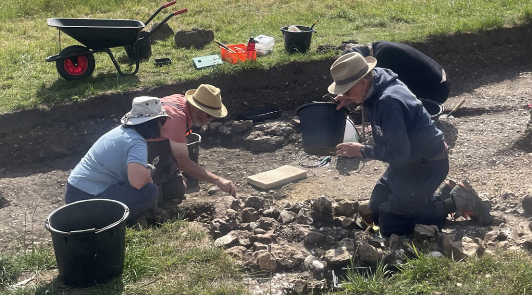
The site is within the grounds of Wickham House, north-east of Newbury, and is investigating a settlement alongside the Roman road of Ermin Street. It is a hilltop site of chalk and clay with natural springs, where metal detectorists had previously found Roman coins and TVAS had undertaken investigations. Geophysical surveys by BAS over two seasons revealed what is believed to be a Roman settlement alongside 800m of Ermin Street. High resolution earth resistance geophysical surveys showed a North – South aligned building, thought to have been built after the Roman road had gone out of use. BAS first excavated the site in 2025, finding evidence of industrial activities including iron working, copper alloy casting and yarn spinning. Below the Medieval features, a concentration of Roman finds included pottery and metal pins, as well as masonry footings and beam slot foundations of Roman buildings.
Excavations continued in 2026 to investigate the buildings, the width of the Roman road and its intersection with a lane. Trench 18 revealed the road to be 19.5m wide road in this location, with a 2m wide associated shallow ditch. Trench 15 was at the intersection of the road and adjoining lane, showing they were constructed at the same time c. AD 50s. The ditch was full of large Sarsen stones, possibly placed to enable the ditch to act as a soakaway. They also provided the foundations for a wall of the Roman building, thought to be from the early 2nd century as evidenced by the finds including glass fragments, coins and brooches. Pottery found in the ditch with burned daub suggested the building burned down in the early 4th century. Trench 16 showed evidence of burning with a circular furnace pit and a chalk-lined flue. As chalk absorbs water, the structure is thought to have been for malting which occurs at lower temperatures than corn drying, which was the original theory. Parallel beam slots aligning exactly with the chalk lined flue suggests this was a malting shed. Also in this trench were postholes, possibly from a timber-framed building with a chalk floor. Trench 12 contained a dump of large flints and CBM, similar to the upper fill of the roadside ditches. It also contained animal bone and both local and imported pottery including Samian ware.
Many interesting finds were excavated over both seasons. In 2025 half a glass melon bead was found, and in 2026 a complete one. These are associated with the military and were either worn on people or horses. An iron stylus was found showing evidence of literacy. Other finds included a mid-3rd century bone hairpin, an antler gaming counter and glass fragments from Roman windows, storage bottles, a long-necked jug and a drinking vessel. There were also many Roman coins, the most interesting of which was a silver denarius from BC 82, minted to pay troops loyal to the Roman general Marius.
What does all this evidence tell us? It suggests the site was occupied from the 1st to the late 4th/early 5th centuries, with roadside services for travellers. There was centralised crop processing and industrial activities including iron and lead-copper alloy working.
The project has included 116 volunteers, from ages 20 to 83, with 44% having had little or no previous archaeological experience. Lectures and site tours have raised £1,700 for St Swithun’s Church, University of Reading students have participated and local schools have been involved. Future work includes more geophysical surveys and ongoing post-excavation analysis of pottery, glass etc. There will be further excavations in 2027, with tentative dates of 30 March – 24 June, every Tuesday, Wednesday and Thursday from 9am – 4pm.
Water Oakley Quarry site: a Roman rural settlement
Alex Guaggenti, John Moore Heritage Services
This presentation gave the results of investigations and excavations from 2016 – 2026 at this Roman rural site in the Middle Thames floodplain, south of Dorney Lake. It is a gravel extraction site with elevated gravel surfaces and east/west aligned palaeochannels. In 2026, 22 out of 70 trenches contained archaeological features from the Late Iron Age to Early Roman periods, with enclosures, pits, postholes and some funerary activity.
Later gravel extraction exposed earlier activities, the oldest being Late Neolithic ring-ditch monuments associated with Neolithic pottery and an Early Bronze Age probable urn. It also revealed an Iron Age rural settlement with postholes and pottery. The Roman evidence pointed to a productive rural landscape from the first to the fourth centuries AD, with a possible barn and many wells, suggesting animal husbandry having been carried out as well as the growing of crops. Most of the wells had timber-framed box linings at their base, that are currently being analysed. One of the earliest wells had a Late Iron Age/Early Roman woven timber base and the wells contained many items including leather shoes, complete pots including local and imported ware, coins from the 2nd to the 4th centuries AD and lots of animal bone. There was also evidence of iron and textile working. There were two Iron Age and one Roman cremated deposit, the latter with four nails indicating a possible wooden box. Water Oakley Quarry is just one component of a wider settled and exploited Roman landscape. Later activity included Saxon pottery deposited in a Late Roman well and Post-Medieval field systems, including ridge and furrow, indicating an extensive agricultural landscape. Alex concluded with a summary of the archaeological investigations and interpretations to date, stating that there are two more seasons of investigations ahead.
Kimbers Lane, Maidenhead
Steve Ford, Thames Valley Archaeological Services
An archaeological investigation was required at this site south-east of Maidenhead, as part of a planning application for housing. It is located on the edge of a floodplain, with a known Roman site to the west, Neolithic pits to the east and Palaeolithic terraces to the north. Steve referenced a paper by Bob Ames regarding a large Mesolithic flint assemblage close to the Kimbers Lane site. 5% of the site was excavated within 25m long trenches. A small amount of Bronze Age activity was found at the top of the hill, but most of the site is Mesolithic. As the site is on a slope, the stratigraphy is difficult to interpret. No peat was found, but there were palaeochannels at the base of the slope. Worked flints were found over the entire site, including blade cores, 40 to 50 microliths and a Palaeolithic handaxe. There were approximately 9,000 flints in total, with around 20 flints per square metre, which is quite dense. Other finds included clay pipes and Roman pottery, suggesting a possible disturbed site.
Sondages were dug across the palaeochannel with finds of flint and pottery. Optically Stimulated Luminescence dating of the palaeochannel resulted in large error ranges, with the lower sample having a range of 23,330 – 6,130 BP and the upper sample 16,360 – 4,560 BP.
Early Mesolithic long blades (>10cm long) are difficult to make and were found at this site. Other worked flints were likely to be from the Bronze Age as well as some Palaeolithic flints. It was concluded that most of the site is Late Mesolithic with some Bronze Age activity at the top of the slope. It was unlikely to have been a large, single-phase site, due to a lack of resources, but was more likely to have been a temporary, seasonal site where Mesolithic people came together.
The presentation finished with a photograph of the star find, a tribach flint measuring 25cm across. This is one of only two or three others found in the UK. They are three-armed prehistoric flints, but their use is unknown.
Iron Age and Roman settlement on the Lambourn Downs
Bob Brewer, independent archaeologist, with contributions from Lindsey Bedford
This presentation concerned a site between Lambourn and Wantage with the Ridgeway passing through it. Two settlement areas covering approximately 50ha were investigated using geophysical survey methods. One site was Washmoor Hill, that has many Bronze Age round barrows and Iron Age pits. Some of these pits are inside and outside of a banjo enclosure, but the uses are unknown. This site also includes the Roman road to Dorchester, Roman roadside activity, a Romano/British enclosure, and a Romano/British shrine opposite the enclosure.
The other site was Stancombe Down, close to the site of what was, in 1887, believed to be a Roman villa, but is now thought to have been an agricultural building. The geophysical surveys of Stancombe Down show lots of activity , including one, or possibly two, banjo enclosures, with Iron Age storage pits. The enclosures are thought to have been defensive structures, with multiple occupancies. There is no trace of them above ground now and it is likely that the Romans flattened them. There is a Roman road running through the site, and in 44AD the 2nd Legion marched here and may have killed the Iron Age occupants at the same time as destroying the enclosure. There is also an area with several roundhouses, probably Romano/British, as well as an Early Roman farmhouse. LIDAR surveys show the location of a pond that is silted up today, but that could have been the original water source. A resistivity survey shows the same pond and two surfaces likely to be roads, one possibly a Roman road associated with a commercial activity, e.g. a route to a market. One was certainly a road in Victorian times and the routes of these two roads can still be seen today as crop marks.
Assemblages of Roman coins have been found here and field walking yields lots of low-quality pottery from the Early Roman period, although the coins are later in age. It is likely that poor people lived here in pre-Roman times, but from 200 AD onwards the area was the location of a large-scale, agricultural commercial enterprise.
Britannia under the boot: The Roman army in south-east England
Dr Edwin Wood, University of London
The presentation began with a map of England and Wales described as a divided isle. The north and west was traditionally defined as the fortified military zone with an army and no towns, while the south and south-east was the civil zone with towns and no army or forts. To answer the question as to where and who is the enemy, can we use militaria as a guide? Militaria however, can be difficult to define. If core artefacts such as swords, armour, helmets, shields and belt fittings are found, this would suggest soldiers were present. Peripheral artefacts such as spears, bows and arrows, horse harness fittings and brooches were used by both soldiers and non-military people.
During Period 2, i.e. AD 70 – 130, not all the forts were contemporary and the core finds were mostly concentrated around towns. During Period 3, i.e. AD 130 – 270, again not all the forts were contemporary, and the army had left many towns such as Chichester and Colchester.
The militaria was actually also present in the ‘civil zone’, as soldiers were regularly despatched to escort officials and collect money, so the Roman military sites were in fact all across England and Wales. Civilians were allowed weapons to use against animal predators and bandits. Imperial systems required constant effort to reinforce their authority. In addition to forts and fortresses, there were fortified Roman towns. Most of these fortified towns were along the central belt and East Anglia, as armies needed to be fed and these areas were the best for raising domestic animals and for growing crops. Were local farmers able to negotiate with armed soldiers? Negotiations with the powerful are rarely fair. In times of hardship, would the army have cared about the impact of its demands on local people? This is unlikely as their priority was themselves. It is also likely that Roman army veterans were discarded into the local populations without any help, so they could have been responsible for banditry.
The conclusions were:
- Rome had no concept of a ‘civil zone’.
- The Roman army considered all of Britain as its territory.
- The distribution of militaria suggests that holding Britain required constant visible effort.
- The army did not micromanage Britain.
- The army’s potential use of towns as bases emphasises the otherness of urban centres.
- The continued assumption of a military/civil divide creates false narratives and hinders our understanding.
Report by Debbie Cousins